

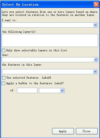
仿照ArcMap实现空间查询功能(不够完善,能实现主体功能)
仿照ArcMap实现空间查询功能(不够完善,能实现主体功能):

 Public Class Select_By_LocationClass Select_By_Location
 Private pMap As IMap Private pLayer1, pLayer2 As ILayer Private pFeaturelayer2 As IFeatureLayer '目标关系图层 Private QueryEnum As ESRI.ArcGIS.Carto.esriSelectionResultEnum Private SpatialRel As esriSpatialRelEnum Private LayerCount As Integer Private Array() As Integer '一个存储1和0值的数组,表示listview中的图层是否能在combbox中显示 Private Array2() As Integer Dim ArrayList_all As ArrayList Dim ArrayList_check As ArrayList Dim button1_Enable1 As Boolean Dim Buffer_distance As Double Dim pMapUnits As esriUnits
 Public Sub New()Sub New() ' 此调用是 Windows 窗体设计器所必需的。 InitializeComponent() ' 在 InitializeComponent() 调用之后添加任何初始化。 InitializeInterface()
 End Sub Private Sub InitializeInterface()Sub InitializeInterface() Dim i As Integer pMap = ArcGIS.AxMapControl1.Map LayerCount = pMap.LayerCount Comb_Layer2.Items.Clear() Comb_QueryEnum.SelectedIndex = 0 Comb_SpatialRel.SelectedIndex = 0 ListView_Layers1.Items.Clear() ReDim Array(LayerCount) ReDim Array2(LayerCount) ArrayList_all = New ArrayList If pMap.LayerCount > 0 Then '只要map中有featurelayer,listview中就会显示;ArrayList_all中就有layer For i = 0 To pMap.LayerCount - 1 If TypeOf pMap.Layer(i) Is IFeatureLayer Then ListView_Layers1.Items.Add(pMap.Layer(i).Name) Array(i) = 1 Array2(i) = 0 ArrayList_all.Add(pMap.Layer(i)) End If Next End If If ListView_Layers1.Items.Count > 1 Then 'listview中图层数大于1,combobox中才显示 For i = 0 To ListView_Layers1.Items.Count - 1 '显示combobox——目标关系图层 If ListView_Layers1.Items.Item(i).Checked = False Then Comb_Layer2.Items.Add(pMap.Layer(i).Name) End If Next If Comb_Layer2.Items.Count > 0 Then Comb_Layer2.SelectedIndex = 0 End If Dim tempLayer As ILayer For i = 0 To ArrayList_all.Count - 1 tempLayer = ArrayList_all(i) If Comb_Layer2.Text = tempLayer.Name Then pLayer2 = ArrayList_all(i) '得到目标图层 End If Next pFeaturelayer2 = pLayer2 Dim pFeatureSelection As IFeatureSelection pFeatureSelection = pFeaturelayer2 If Not pFeatureSelection.SelectionSet Is Nothing Then Label6.Text = pFeatureSelection.SelectionSet.Count & " features selected" Else Label6.Text = "0 features selected" End If Label7.Text = Comb_Layer2.Text Else Label6.Text = "0 features selected" Label7.Text = "" End If Button1.Enabled = False TextBox_distance.Enabled = False Comb_unit.Enabled = False SpatialRel = esriSpatialRelEnum.esriSpatialRelIntersects QueryEnum = esriSelectionResultEnum.esriSelectionResultNew End Sub Private Sub Display_Comb_Layer2()Sub Display_Comb_Layer2() Comb_Layer2.Items.Clear() Dim i As Integer For i = 0 To ListView_Layers1.Items.Count - 1 If Array(i) = 1 Then Comb_Layer2.Items.Add(pMap.Layer(i).Name) End If Next If Comb_Layer2.Items.Count > 0 Then Comb_Layer2.SelectedIndex = 0 ElseIf Comb_Layer2.Items.Count = 0 Then Comb_Layer2.Text = "" End If For i = 0 To LayerCount - 1 If Array2(i) = 1 Then button1_Enable1 = True Exit For End If Next If i = LayerCount Then button1_Enable1 = False End If If button1_Enable1 = True And Comb_Layer2.Items.Count > 0 Then Button1.Enabled = True Else Button1.Enabled = False End If End Sub '//////单击listview中checkbox,动态改变combobox中图层显示(通过数组Array值实现) Private Sub ListView_Layers1_ItemChecked()Sub ListView_Layers1_ItemChecked(ByVal sender As Object, ByVal e As System.Windows.Forms.ItemCheckEventArgs) Handles ListView_Layers1.ItemCheck If e.CurrentValue = CheckState.Unchecked And e.NewValue = CheckState.Checked Then Array(e.Index) = 0 Array2(e.Index) = 1 End If If e.CurrentValue = CheckState.Checked And e.NewValue = CheckState.Unchecked Then Array(e.Index) = 1 Array2(e.Index) = 0 End If Display_Comb_Layer2() End Sub Private Sub Button2_Click()Sub Button2_Click(ByVal sender As System.Object, ByVal e As System.EventArgs) Handles Button2.Click Me.Close() End Sub Private Sub Comb_QueryEnum_SelectedIndexChanged()Sub Comb_QueryEnum_SelectedIndexChanged(ByVal sender As Object, ByVal e As System.EventArgs) Handles Comb_QueryEnum.SelectedIndexChanged Select Case Comb_QueryEnum.SelectedIndex Case 0 QueryEnum = esriSelectionResultEnum.esriSelectionResultNew Case 1 QueryEnum = esriSelectionResultEnum.esriSelectionResultAdd Case 2 QueryEnum = esriSelectionResultEnum.esriSelectionResultSubtract Case 3 QueryEnum = esriSelectionResultEnum.esriSelectionResultAnd End Select End Sub Private Sub Comb_SpatialRel_SelectedIndexChanged()Sub Comb_SpatialRel_SelectedIndexChanged(ByVal sender As Object, ByVal e As System.EventArgs) Handles Comb_SpatialRel.SelectedIndexChanged Select Case Comb_SpatialRel.SelectedIndex Case 0 SpatialRel = esriSpatialRelEnum.esriSpatialRelIntersects Case 1 SpatialRel = esriSpatialRelEnum.esriSpatialRelIntersects Case 2 SpatialRel = esriSpatialRelEnum.esriSpatialRelContains '完全包括 Case 3 SpatialRel = esriSpatialRelEnum.esriSpatialRelWithin Case 4 SpatialRel = esriSpatialRelEnum.esriSpatialRelUndefined Case 5 SpatialRel = esriSpatialRelEnum.esriSpatialRelUndefined Case 6 SpatialRel = esriSpatialRelEnum.esriSpatialRelTouches Case 7 SpatialRel = esriSpatialRelEnum.esriSpatialRelUndefined Case 8 SpatialRel = esriSpatialRelEnum.esriSpatialRelEnvelopeIntersects Case 9 SpatialRel = esriSpatialRelEnum.esriSpatialRelContains '只能对polygon操作 Case 10 SpatialRel = esriSpatialRelEnum.esriSpatialRelWithin End Select If Comb_SpatialRel.SelectedIndex = 1 Then CheckBox3.CheckState = CheckState.Checked TextBox_distance.Enabled = True Comb_unit.Enabled = True Else CheckBox3.CheckState = CheckState.Unchecked TextBox_distance.Enabled = False Comb_unit.Enabled = False End If End Sub '//////查询函数 Function Query()Function Query(ByVal pQueryFeatureLayer As IFeatureLayer, ByVal pRelationFeatureLayer As IFeatureLayer) As Boolean Dim pFeatureSelection As IFeatureSelection Dim pSelectionSet As ISelectionSet Dim pFeatureCursor As IFeatureCursor Dim pGeoCollection As IGeometryCollection Dim pFeature As IFeature Dim pTopo As ITopologicalOperator Dim pGeometry As IGeometry Dim pBuffer As IGeometry '/////////得到目标关系图层选择集或所有feature的一个GeoCollection pFeatureSelection = pRelationFeatureLayer pSelectionSet = pFeatureSelection.SelectionSet If pSelectionSet.Count > 0 Then pSelectionSet.Search(Nothing, False, pFeatureCursor) '必须是False,否则出现异常“尝试读取或写入受保护的内存。这通常指示其他内存已损坏。” Else pFeatureCursor = pRelationFeatureLayer.FeatureClass.Search(Nothing, False) End If pGeoCollection = New GeometryBag If CheckBox3.CheckState = CheckState.Unchecked Then pFeature = pFeatureCursor.NextFeature Do While Not pFeature Is Nothing pGeoCollection.AddGeometry(pFeature.Shape) pFeature = pFeatureCursor.NextFeature Loop Else Try If TextBox_distance.Text <> "" Then If pMapUnits = esriUnits.esriMeters Then If Comb_unit.SelectedIndex = 0 Then '得到缓冲距离 Buffer_distance = CDbl(TextBox_distance.Text) * 1000 ElseIf Comb_unit.SelectedIndex = 1 Then Buffer_distance = CDbl(TextBox_distance.Text) ElseIf Comb_unit.SelectedIndex = 2 Then Buffer_distance = CDbl(TextBox_distance.Text) End If ElseIf pMapUnits = esriUnits.esriKilometers Then If Comb_unit.SelectedIndex = 0 Then Buffer_distance = CDbl(TextBox_distance.Text) ElseIf Comb_unit.SelectedIndex = 1 Then Buffer_distance = CDbl(TextBox_distance.Text) / 1000 ElseIf Comb_unit.SelectedIndex = 2 Then Buffer_distance = CDbl(TextBox_distance.Text) End If ElseIf pMapUnits = esriUnits.esriUnknownUnits Then Buffer_distance = CDbl(TextBox_distance.Text) End If Else Buffer_distance = 0 End If Catch ex As Exception Buffer_distance = 0 End Try pFeature = pFeatureCursor.NextFeature Do While Not pFeature Is Nothing pGeometry = pFeature.Shape pTopo = pGeometry pBuffer = pTopo.Buffer(Buffer_distance) pGeoCollection.AddGeometry(pBuffer) pFeature = pFeatureCursor.NextFeature Loop End If 'MsgBox(pGeoCollection.GeometryCount) '/////////定义SpatialFilter Dim pFilter As ISpatialFilter pFilter = New SpatialFilter With pFilter .Geometry = pGeoCollection .GeometryField = "shape" .SpatialRel = SpatialRel End With '////////得到待选图层 Dim pSelectFeatures As IFeatureSelection pSelectFeatures = pQueryFeatureLayer '///////查询 pSelectFeatures.SelectFeatures(pFilter, QueryEnum, False) If Not pSelectFeatures.SelectionSet Is Nothing Then pSelectFeatures.SelectionSet.Refresh() ArcGIS.AxMapControl1.ActiveView.Refresh() Return True Exit Function End If Return False pGeoCollection = Nothing pFilter = Nothing End Function Private Sub Button1_Click()Sub Button1_Click(ByVal sender As System.Object, ByVal e As System.EventArgs) Handles Button1.Click Dim LayerIndex As ListView.CheckedIndexCollection Dim pFeatureLayer1 As IFeatureLayer LayerIndex = ListView_Layers1.CheckedIndices Dim i As Integer ArrayList_check = New ArrayList For i = 0 To LayerIndex.Count - 1 ArrayList_check.Add(ArrayList_all(LayerIndex.Item(i))) '得到待查寻图层,可能有多个 Next For i = 0 To ArrayList_check.Count - 1 pLayer1 = ArrayList_check(i) pFeatureLayer1 = pLayer1 'MsgBox(pFeatureLayer1.Name) 'MsgBox(pFeatureLayer2.Name) Query(pFeatureLayer1, pFeatureLayer2) Next End Sub Private Sub Comb_Layer2_SelectedIndexChanged()Sub Comb_Layer2_SelectedIndexChanged(ByVal sender As Object, ByVal e As System.EventArgs) Handles Comb_Layer2.SelectedIndexChanged Dim i As Integer Dim tempLayer As ILayer For i = 0 To ArrayList_all.Count - 1 tempLayer = ArrayList_all(i) If Comb_Layer2.Text = tempLayer.Name Then pLayer2 = ArrayList_all(i) '得到目标图层 End If Next pFeaturelayer2 = pLayer2 Dim pFeatureSelection As IFeatureSelection pFeatureSelection = pFeaturelayer2 If Not pFeatureSelection.SelectionSet Is Nothing Then Label6.Text = pFeatureSelection.SelectionSet.Count & " features selected" Else Label6.Text = "0 features selected" End If Label7.Text = Comb_Layer2.Text End Sub Private Sub CheckBox3_CheckedChanged()Sub CheckBox3_CheckedChanged(ByVal sender As Object, ByVal e As System.EventArgs) Handles CheckBox3.CheckedChanged If CheckBox3.CheckState = CheckState.Unchecked Then TextBox_distance.Enabled = False Comb_unit.Enabled = False Else TextBox_distance.Enabled = True Comb_unit.Enabled = True End If If Comb_unit.Enabled = True Then Comb_unit.SelectedIndex = 1 End If End Sub Private Sub Select_By_Location_Load()Sub Select_By_Location_Load(ByVal sender As Object, ByVal e As System.EventArgs) Handles Me.Load Me.FormBorderStyle = Windows.Forms.FormBorderStyle.FixedDialog 'Dim pArcGIS As New My_ArcGis.ArcGIS Dim sMapUnits As String = Nothing pMapUnits = ArcGIS.AxMapControl1.MapUnits End Sub
 End Class
 浙公网安备 33010602011771号