
今天我们来攻克第二项——可交互式中国地图。
一开始我想用webview配合Echart来实现相应的效果,但奈何我json和html传值那一部分根本就没学,所以即使实现了效果也无法向其中传值……
所幸后来我又找到了一种新方法——SVG转XML绘图法
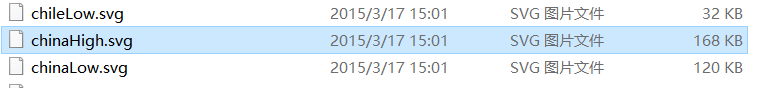
首先我们需要一个SVG文件,这里有个地图SVG的整合包,找到China就可以了
https://pan.baidu.com/s/1Z1E_hwG73IM39idcWoJx2w 提取码:e6br
因为这个SVG是转成xml格式,不需要额外导入包,所以这样咱们就算准备完全了
我们先找到chinaHigh.svg(low也行,但high分辨率高更细节)
然后访问这个网址:http://inloop.github.io/svg2android/,这是一个把SVG改组成xml的工具,只要把它拖进去就OK,非常便利
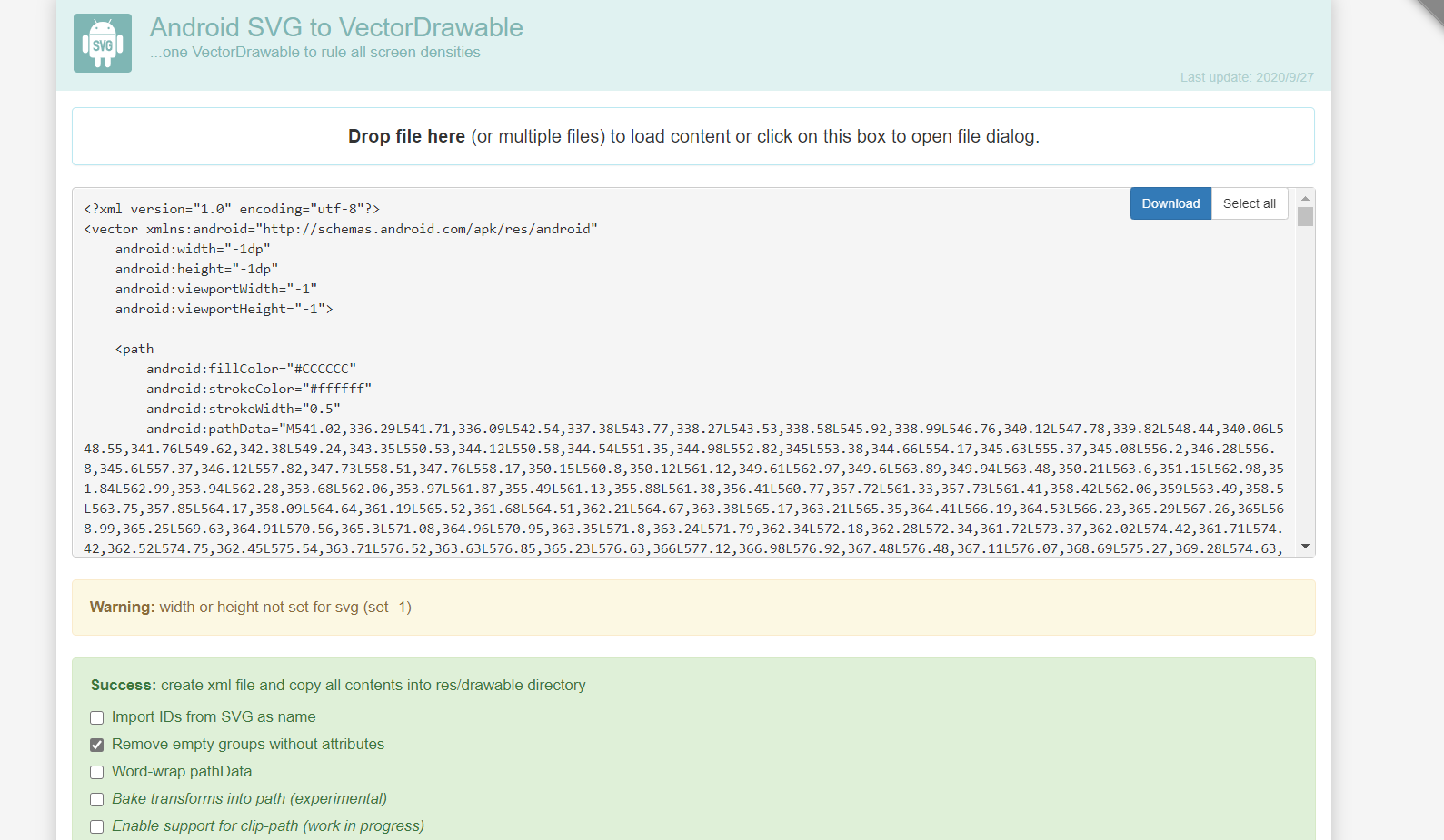
点击下载之后,把它放到咱们Android工程的app\src\main\res\raw下
之后先包装工具类:Chinaitem

public class chinaitem {

    private Path path;
    private int drawColor;
    String name;

    public chinaitem(Path path) {
        this.path = path;
    }

    /**
     * 绘制地图path
     * @param canvas
     * @param paint
     * @param isSelect
     */
    public void draw(Canvas canvas, Paint paint, boolean isSelect){
        if(isSelect){
            //画阴影图层
            paint.setStrokeWidth(2);
            paint.setShadowLayer(8,0,0,0xffffff);
            paint.setStyle(Paint.Style.FILL);
            paint.setColor(Color.BLACK);
            canvas.drawPath(path,paint);
            //画区域path
            paint.clearShadowLayer();
            paint.setStrokeWidth(2);
            paint.setStyle(Paint.Style.FILL);
            paint.setColor(Color.parseColor("#FBED6C"));

            canvas.drawPath(path,paint);
        }else{
            //画线条
            paint.clearShadowLayer();
            paint.setStrokeWidth(1);
            paint.setStyle(Paint.Style.STROKE);
            paint.setColor(0xFFD0E8F4);
            canvas.drawPath(path,paint);
            //画区域
            paint.setStrokeWidth(2);
            paint.setStyle(Paint.Style.FILL);
            paint.setColor(drawColor);
            canvas.drawPath(path,paint);
        }
    }

    /**
     * 判断当前点击坐标是否在path范围内
     * @param x
     * @param y
     * @return
     */
    public boolean isTouch(int x,int y){
        RectF rectF = new RectF();
        path.computeBounds(rectF,true);
        Region region = new Region();
        region.setPath(path,new Region((int)rectF.left,(int)rectF.top,(int)rectF.right,(int)rectF.bottom));//判断X,Y是否在region区域范围内
        if(region.contains(x,y)) return true;
        return false;
    }

    public void setDrawColor(int drawColor) {
        this.drawColor = drawColor;
    }
}
编写新的view控件
public class ChinaMapView extends View {
    private static final String TAG = ChinaMapView.class.getName();
    public List<chinaitem> chinaitems = new ArrayList<chinaitem>();
    //被点击的区域
    private chinaitem selectItem;
    //缩放1.3倍
    public float scale = 1.3f;
    private Context mContext;
    private Paint mPaint;
    private int[] colors = new int[]{0xFF239BD7,0xFF30A9E5,0xFF80CBF1,0xFFF0E68C};
    GestureDetectorCompat gestureDetectorCompat;

    public  ChinaMapView(Context context) {
        super(context);
    }

    public  ChinaMapView(Context context, AttributeSet attrs) {
        super(context, attrs);
        init(context);
    }

    private void init(Context context) {
        mContext = context;
        mPaint = new Paint();
        mPaint.setAntiAlias(true);
        gestureDetectorCompat = new GestureDetectorCompat(context,new GestureDetector.SimpleOnGestureListener(){
            @Override
            public boolean onDown(MotionEvent e) {
                Log.d(TAG,"onDown x:"+e.getX()+";y:"+e.getY());
                handleTouch(e.getX(),e.getY());
                return true;
            }
        });
        thread.start();
    }

    @Override
    protected void onDraw(Canvas canvas) {
        super.onDraw(canvas);
        canvas.save();
        canvas.scale(scale,scale);
        if(taiwanItems != null){
            for(chinaitem:taiwanItems){
                if(item != selectItem){
                    item.draw(canvas,mPaint,false);
                }
            }
            if(selectItem != null){
                selectItem.draw(canvas,mPaint,true);
            }
        }
    }

    @Override
    public boolean onTouchEvent(MotionEvent event) {
        return gestureDetectorCompat.onTouchEvent(event);
    }

    public void handleTouch(float x,float y){
        chinaitem chinaitem = null;
        if(chinaitems != null){
            for(chinaitem item :chinaitems){
                if(item.isTouch((int)(x/scale),(int)(y/scale))){
                    chinaitem = item;
                    break;
                }
            }
            if(chinaitem!= null) {
                selectItem = chinaitem;
                postInvalidate();
            }
        }
    }

    Thread thread = new Thread(){
        @Override
        public void run() {
            InputStream inputStream = mContext.getResources().openRawResource(R.raw.chinahigh);
            //采用Dom解析器解析xml
            DocumentBuilderFactory factory = DocumentBuilderFactory.newInstance();
            DocumentBuilder builder = null;
            try {
                builder = factory.newDocumentBuilder();
                Document doc = builder.parse(inputStream);
                Element rootelement = doc.getDocumentElement();
                NodeList items = rootelement.getElementsByTagName("path");
                for(int i=0;i<items.getLength();i++){
                    Element element = (Element) items.item(i);
                    String pathData = element.getAttribute("android:pathData");
                    Path path = PathParser.createPathFromPathData(pathData);
                    TaiWanItem item = new TaiWanItem(path);
                    taiwanItems.add(item);
                }
                handler.sendEmptyMessage(1);
            } catch (ParserConfigurationException e) {
                e.printStackTrace();
            } catch (SAXException e) {
                e.printStackTrace();
            } catch (IOException e) {
                e.printStackTrace();
            }
        }
    };

    Handler handler = new Handler(){
        @Override
        public void handleMessage(Message msg) {
            if(taiwanItems == null || taiwanItems.size()==0)
                return;

            int colorNum = taiwanItems.size();
            int color = Color.WHITE;
            //赋予颜色
            for(int i=0;i<colorNum;i++){
                int flag = i % 4;
                switch(flag){
                    case 1:
                        color = colors[0];
                        break;
                    case 2:
                        color = colors[1];
                        break;
                    case 3:
                        color = colors[1];
                        break;
                    default:
                        color = colors[2];
                }
                chinaitem.get(i).setDrawColor(color);
            }
            postInvalidate();
        }
    };
}
这样我们就实现了地图显示,之后我们要在Activity里使用它,并且在后台Java代码里
再次重载onTouch函数来完成变色和取值。在那之前,我们先定义这样一个字符串
String[] pos=new String[]{"安徽","北京","重庆","福建","广东","甘肃","广西"
            ,"贵州","海南","河北","河南","香港","黑龙江","湖南","湖北","吉林"
            ,"江苏","江西","辽宁","澳门","内蒙古","宁夏","青海","陕西","四川","山东","上海","山西","天津","台湾","新疆","西藏","云南","浙江"};
由于地图的构筑是靠一个Arraylist数组逐个完成的,所以可以用这个字符串按照构造时的直接得到点击时的地理位置(我就没呢么好运啦,是照着返回结果和地图一个个对过来的。)
之后重写控件的onTouch函数:
tp.setOnTouchListener(new View.OnTouchListener() {
            @Override
            public boolean onTouch(View v, MotionEvent event) {
                for(int i=0;i<tp.chinaitem.size();i++) {
                    if(tp.chinaitem.get(i).isTouch((int)(event.getX()/tp.scale),(int)(event.getY()/tp.scale))){
                        op.setText(pos[i]);
                        tp.handleTouch(event.getX(),event.getY());
                        po.setText("该省/直辖市/特别行政区有"+dao.sere(pos[i]).size()+"条记录,其中异常记录"+dao.sered(pos[i]).size()+"条");
                        os.setVisibility(View.VISIBLE);
                        break;
                    }else {
                        os.setVisibility(View.INVISIBLE);
                    }
                }
                return true;
            }
        });
其中先调用了isTouch函数判断触点是否在合法区域,之后再调用handleTouch函数改变颜色。
最后的效果就像这样:
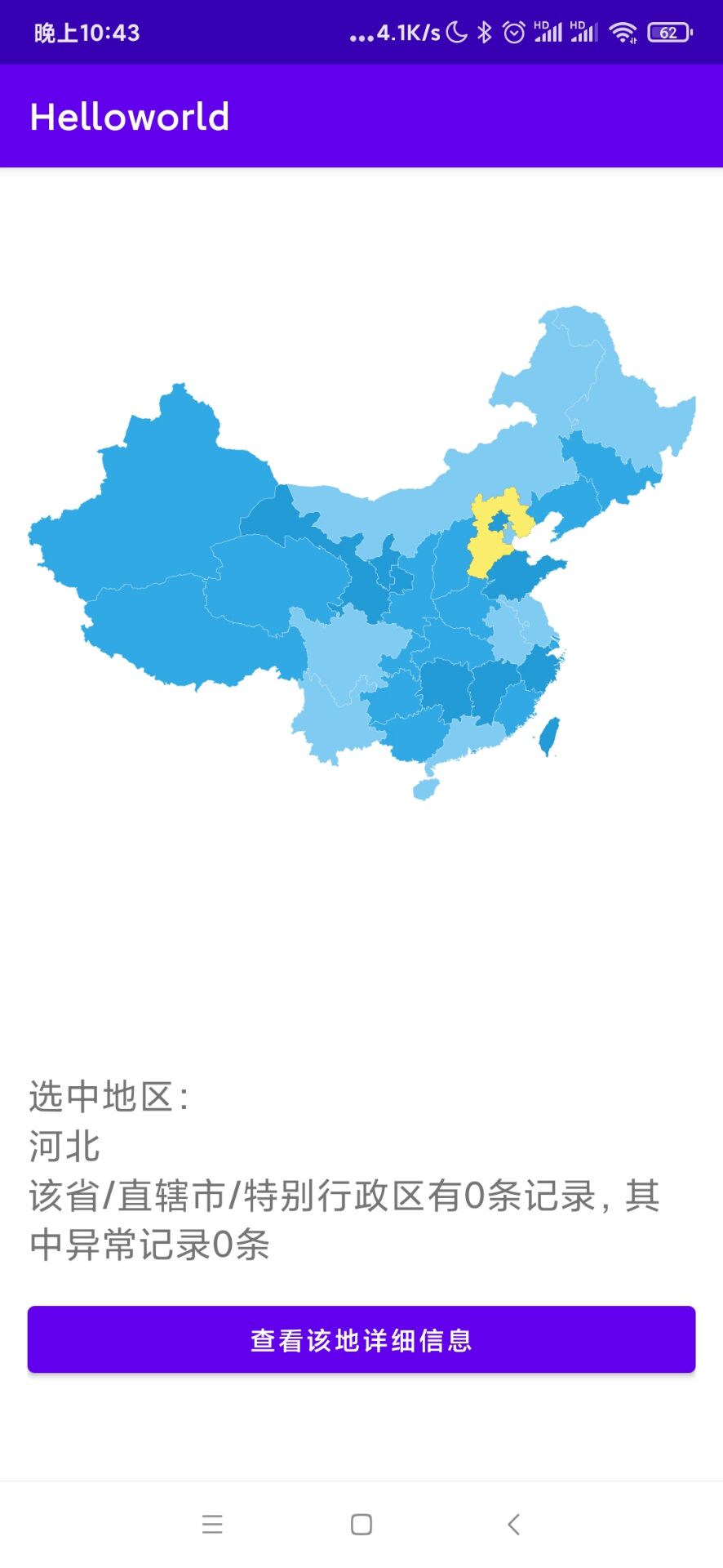
好,这就算成功了!那么今天就到这里,我们明天见咯!

 浙公网安备 33010602011771号