


URL:http://www.sharpgis.net/page/SQL-Server-2008-Spatial-Tools.aspx
http://www.sharpgis.net/post/2007/12/23/Shapefile-to-SqlServer-2008-to-WPF.aspx
http://www.sharpgis.net/post/2007/12/Shapefile-to-SqlServer-2008-to-WPF.aspx

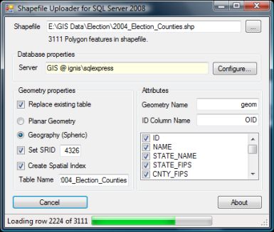
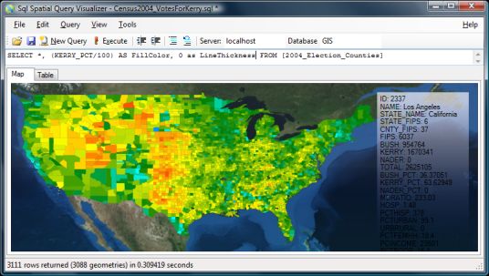
The SQL Spatial Tools consists of two tools to make it easy to get experience with the new spatial capabilities of SQL Server 2008 (click for more info) :
- Shape2SQL : Uploads ESRI Shapefiles to Microsoft SQL Server Spatial.
- SqlSpatial Query Tool : Queries MSSQL Server 2008 and displays geometry output on a WPF-based interactive map.
Requirements:
- A SQL Server 2008 to connect to (DUH!)
- Microsoft .NET 3.5
- Either "SQL Server 2008" or "Microsoft SQL Server System CLR Types" installed on client machine.
Download
Related blogposts:

 浙公网安备 33010602011771号